![]()
![]()
 |
 |
|
The Arizona-Sonora Border:
Line, Region, Magnet, and Filter
. . . Belonging truly to neither nation, it serves as a kind of cultural buffer zone for both, cultivating its own culture and traditions. Like other borders, it both attracts and repels. Like them, it is both barrier and filter. It is above all a stimulating cultural environment. . . .
--James S. Griffith
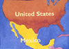
The Arizona Sonora border was established as a result of the Gadsden Purchase of 1853. It runs through desert and mountain country, from the western Chihuahuan Desert by New Mexico through a zone of grassland and oak-covered hills to the classic Sonoran Desert west of Nogales. The land gets more and more arid as one travels west, and the western third of the border is essentially devoid of human habitation. It is this stretch of the border, once a major road to the Colorado River, that has earned and kept the title El Camino del Diablo, "The Devil's Highway."
There are six ports of entry on the Arizona-Sonora border. From east to west these paired towns are Douglas/Agua Prieta, Naco/Naco, Nogales/Nogales, Sasabe/Sasabe, Lukeville/ Sonoyta, and San Luis Rio Colorado, which has no corresponding town on the Arizona side. Between these towns stretches the border, for the most part marked by a three-strand, barbed-wire fence and a series of monuments. The border monuments are spaced so that each one is visible from its counterpart to the east and to the west. The fence traverses valleys, mountains, lush thickets, and sparse desert shrubbery.
Where it crosses true desert, truly deserted country, it is a simple three-strand, barbed-wire fence. In other stretches it changes to chain-link or, as recently between the two Nogaleses, to metal strips.
In the local Spanish, one enters the country illegally "de alambre," "through the wire." One who does this is an "alambrista," a "wireist." There are more sophisticated techniques as well. In 1990, customs officials discovered an elaborate tunnel leading from a warehouse in Agua Prieta to a similar structure in Douglas, Arizona. Hydraulic equipment had been installed at either end, and the whole set-up was capable of handling considerable quantities of goods. At least three corridos have been written and circulated about "el Tunel."
The fence serves other, more localized purposes from time to time. During the 1980s, an international volleyball game was regularly held near Naco. Each team played in its own country, with the chain-link fence serving as the net.
To the east, in Agua Prieta, match racing has long been an important form of recreation. In 1957, a horse named Relampago (Lightening) won an important race and became the instant target of many challenges. One of the challengers was Chiltepin (named after the fiery local wild chile), from Pirtleville on the U.S. side. Hoof-and-mouth regulations made it impossible for either horse to cross into the other's country. The solution: each horse ran on its own side of the fence. Relampago won that one, too.
The international border creates more than a fence between countries. It also creates a denationalized zone, a region extending for many miles into each nation.
I keep being told that Nogales, Sonora,"isn't the real Mexico." That is perfectly true, of course, just as Nogales, Arizona, "isn't the real United States." Each is a border community, attracting business from the other side of the line. Folks cross the border each day to shop, work, and socialize. Each town has taken on some of the character of its counterpart on the other side of the line. For the traveler from Michigan in the United States or Michoacan in Mexico, the foreign flavor starts long before one arrives at the border crossing, and reminders of home persist long after one has crossed over into the other country.
The border attracts. Manufactured goods gravitate to it on their way into Mexico, and enough vegetables are attracted northward to feed much of the western United States. The border region attracts tourists and travelers from the United States, seeking just to sample the charms of a foreign country, or passing through on their way further south into Mexico. An increasing number of businesspeople and investors are drawn here, too. It attracts tourists from Mexico as well as those in search of economic opportunities. Those may involve the assembly plants known as maquikadoras on the Sonoran side of the border, or they may lie farther north in the United States. Many opportunity-seekers cross the border illegally.
This brings us to another important function of the border. As well as defining a subregion that is neither one place nor another, as well as serving as a magnet that draws goods and people from both countries, the border is also a barrier. It is intended to filter out undesirable influences going in both directions. So the U.S. Immigration and Naturalization Service and the Border Patrol fight an unceasing and frustrating battle to ensure that only authorized, documented individuals cross into the United States. On the other side, Mexican Customs fights an equally endless campaign against the importation of untaxed goods, especially automobiles, into Mexico.
Another battle--a war, in fact--is constantly fought across the length and breadth of the border region between drug smugglers and those who would prohibit their traffic into the United States. This war touches the lives of everyone living within a hundred miles of the border, while at the same time it remains almost completely invisible. Traces of it may be seen, of course, in newspaper headlines, in robberies by addicts, in the magical spells and prayers to dark powers which show up in displays of religious articles for sale, and in restrictions on travel to some deserted areas near the border. But many border residents shrug, remark that only drug people seem to be involved in the shoot-outs, and go on in their everyday way.
The border has touched the region's Native Americans in special ways. The Tohono O'odham claim ancestral lands on both sides of the border, and many interpret the Gadsden Purchase agreement as having granted them the right to move freely across the border within their lands. But O'odham land is being encroached upon by Mexican farmers and others in Sonora, and the stretch of the border that runs through O'odham land is vulnerable to smugglers. As a result, one needs a permit nowadays to travel along the southern portion of the Tohono O'odham Nation near the border, and crossings are not as easy as they once were for the O'odham themselves.
Yaqui Indians live on both sides of the border as well. Those living in southern Arizona claim as their homeland the valley of the Rio Yaqui, which is three hundred miles south of the border. Especially at Easter time, Yaqui ritual musicians and dancers who live in Mexico travel north with their necessary regalia and instruments, crossing the border at Nogales and going on to Tucson to help their kinfolk perform necessary religious ceremonies in the United States. Their ritual equipment has long puzzled some U.S. customs officials, and a booklet was issued around 1980 to convince government employees, for instance, that a long string of dried cocoon-husks is a leg rattle rather than a device for concealing heroin.
There is one more important observation to be made about the Arizona-Sonora border, or at least about its central part. It runs right down the middle of what is still, after almost one hundred and fifty years, a cultural region in its own right. When Eusebio Francisco Kino, S..J. arrived in this region in 1686 as its first permanent European resident, he called the country he moved into "la Pimeria Alla," or "Upper Pima Country." This distinguished it from regions to the south where Piman languages were also spoken, as well as from the lands to the southeast and southwest, occupied respectively by Seris and Opatas. To the north of the Pimeria Alta were lands occupied by other peoples, most particularly the Apaches. Three hundred years later, the Pimeria Alta is still a cultural region, even though it has been divided between two nations that did not exist in Kino's day.
The region is unified by several elements. There are still Piman speakers (O'odham in their own language) on both sides of the border. Also, much the same in both countries is Mexican ranching culture, many of whose principal families straddle the border. The traditional, Jesuit-introduced, folk diet based on wheat, cheese, and beef is consistent throughout the region, as is the use of the unique tortilla grande de harina, the huge wheat flour tortilla that can measure well over a foot across, and whose lard content often renders it translucent. And finally, the region is bound together through a strong devotion to the composite San Francisco, whose statue stands in Magdalena de Kino, Sonora.
Although the image in Sonora represents St. Francis Xavier, the day on which the annual fiesta is celebrated is October 4, the Feast of St. Francis of Assisi in the Roman Catholic calendar. This composite San Francisco is of tremendous regional importance, and his fiesta draws thousands of pilgrims from north of the border: Mexican Americans, Tohono O'odham, and Yaquis, with a few Anglos thrown in for good measure. Among the religious goods offered for sale to pilgrims at the Fiesta de San Francisco are colorful, reverse-painted glass frames for holy pictures.
These frames are made by several extended families of craftspeople. Each frame consists of a sheet of glass which has been painted with geometric or floral motifs on the back. Both opaque and translucent paints are used, and a rectangular space is left undecorated, for the holy card. The glass is then backed, first with a layer of crumpled tinfoil, and then with either cardboard or tin. The tinfoil gives a wonderful, shimmering quality to the translucent paint on the glass. While holy pictures are inserted into many of the frames, others are left bare, so the purchaser can insert a favorite saint's picture or even the portrait of a family member.
Many of these frames are purchased by Tohono O'odham and are taken back across the border to the altars of the small chapels which dot the Tohono O'odham Nation. Others are bought by Mexicans, Mexican Americans, and Yaquis and used on home altars. Some, however, are bought by Anglo Americans, especially in the past ten years, during which time the painted frames have been exhibited in Tucson and Nogales as traditional art. In Mexican and Indian hands, the frames are colorful decorations for beloved holy pictures or family portraits. In Anglo hands, however, the frames themselves become the icons symbols of the region and of its traditions.
In a like way, pinatas and cascarones (decorated eggshells which have been filled with confetti and mounted on decorated paper cones and which are broken over party-goers' heads to increase the festive ambiente of the occasion) are purchased by some Anglos for their original, intended use, by others for use as wall decorations. In this guise they become visible symbols of the region and statements of their owners' sensitivity to the region. By the same token, some folk Catholic shrines in Tucson and elsewhere have become tourist destinations for Anglos wishing to understand regional traditions.
This then, is the Arizona-Sonora border. Belonging truly to neither nation,
it serves as a kind of cultural buffer zone for both, cultivating its own
culture and traditions. Like other borders, it both attracts and repels.
Like them, it is both barrier and filter. It is above all a stimulating
cultural environment. After thirty years as a resident, I can honestly say
that I can think of no other place I would rather be.
About the Author
James S. Griffith is Director of the Southwest Folklore Center of Arizona.
He is a native of southern California and has called the Pimena Alta home
since the early 1960s.
Further Reading
Griffith, James S. Southern Arizona Folk Arts. Tucson: University of
Arizona Press, 1988.
_______________. Beliefs and Holy Places: A Spiritual Geography of the Pimeria
Alta. Tucson: University
of Arizona Press,1992.
Weisman, Alan. La Frontera: the United States Border with Mexico. Tucson:
University of Arizona Press, 1991.
![]()