
|
Home | Lesson Plans |
 |
Establishing Borders: The Expansion of the United States, 1846-48 |
|
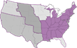
Lesson 1: Expansion of the United States Lesson 1 - Map 1A - Map 1B
Note: Answers or suggested responses to discussion questions appear in italics. 1. Begin a class discussion by asking your students how many states were in the Union when the United States declared its independence from Britain in 1776. There were thirteen states. All were on the eastern seaboard. Stress that the United States also held additional territory that stretched to the Mississippi River in the west; from the Great Lakes in the north, to near the Gulf of Mexico in the south. Refer students to a map of the period. 2. Look at a contemporary map of the United States and ask how many states are now in the Union, as compared with those in 1776. Forty-eight of the fifty states are located across the length of the continent, Alaska and Hawaii are isolated. Emphasize that U.S. territory grew rapidly in the nineteenth century with the huge Louisiana Purchase in 1803 and treaties with Spain and Britain. 3. Stress that the United States had very different boundaries in 1840 than it does today. Use Map 1A and a current map of the United States to identify which states were in the Union in 1840. Emphasize that vast areas of what is now the United States were either claimed or held by Mexico, the Republic of Texas, or Britain in 1840. Ask students if your state was either a territory or part of a foreign nation in 1840. 4. Direct your students to use Map 1B and a current map of the United States to identify which states were admitted to the Union by 1850. These were California, Florida, Wisconsin, Iowa, and Texas. 5. Compare Map 1A and Map 1B. What major territorial changes occurred during the 1840s? Texas became a state, Mexico lost nearly all its territory, and Britain gave up its claim to the Oregon Country below the 49th parallel. 6. Stress that between 1846 and 1848 the United States gained more than one million square miles of territory. Be sure to note that the United States acquired Oregon Country peacefully through a treaty with Britain, while it took a war with Mexico to obtain the lands in the Southwest. 7. Use Map 1B and a current map of the United States to identify which states were later formed from the territory acquired from Mexico. California, Nevada, Utah, New Mexico, Arizona, and portions of Colorado, Wyoming, Oklahoma, and Kansas were formed from this territory. Identify which states were later formed from the territory acquired from Britain. Washington, Oregon, Idaho, and portions of Wyoming and Montana were formed from this territory. |
| ||||||||||


