Objectives
- Identify major geographical features of Japan
- Interpret Japan's geographical location with reference to the United States
Materials
- Copies of Activity Page 1
- Maps of the world, Japan, and the United States (you might also use the atlas section of your social studies book)
- Pens, pencils, colored markers, crayons
Subjects
Geography, social studies
Procedure
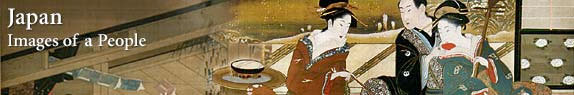
1. Tell your students that during the next few class meetings they'll be studying some of the traditional art of Japan. Ask them to describe Japan's location in the world relative to the United States. Answers may vary, but students will probably conclude that the Japanese chain of islands is a great distance from the United States and close to the larger land mass of Asia.
2. Give each student a copy of Activity Page 1, "Mapping It Out," and other maps you have collected. Using Background Essay 1 as a guide, tell your students that Japan consists of a chain of mountainous islands that cover more than one thousand miles (1,600 km) from north to south — about the distance from Maine to Florida in the United States. Emphasize that only relatively small coastal areas of Japan are suitable for settlement and farming and that there is a great variation in climate from north to south.
3. Direct your students to Activity Page 1. Ask them to estimate the distance between the west coast of the United States and Japan using the provided inset map of the world or maps in their social studies books or atlases. (Be sure to stress the importance of a map's scale in determining distance.) Students should conclude that Japan is about 6,200 miles (10,000 km) from the West Coast of the United States. Have them measure its distance from the coast of Asia. To place the measurements in perspective, have students determine distances between their community and diverse parts of the United States as well as between different points on the island chain.
4. Ask your students to complete the map of Japan included in Activity Page 1 by placing the names of the selected islands, bodies of water, and cities in the correct locations. (Younger students might enjoy coloring the landforms and bodies of water.) When your students have finished the activity, ask them to think about whether an island location might affect the culture of a people (you might also refer to other island nations such as Great Britain, Australia, and Cuba). How do people overcome geographic barriers? (Consider related issues such as trade and language.) Mention that traditional Japanese culture incorporated both indigenous elements and cultural influences from China and other areas of the Asian mainland. Also note that the sea is an important resource to island peoples, both as a source of food and as a natural means of transportation.
5. Conclude the lesson by telling students that in the next step they will be asked to observe how geographical features appear in the traditional art of Japan.
|